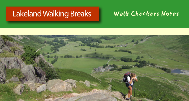
June 2016. A near perfect day weather wise, and as it turned out the ideal day for shooting a video of the walk from Grasmere up to Alcock Tarn. The views are so good on this walk that a clear day with sunshine and fluffy white clouds is essential. But this shoot has an added bonus. I have a couple of production assistants (first class, unpaid) to help me out. My good friend Nicola and her son Michael. Nicola is a bright and busy single mum who loves to get out on the Lake District fells whenever she can. Michael has a very enquiring mind, and is developing an interest in history, as well as all things artistic, including videography. It was a chance for them to experience a very different day on the fells, and to also see what goes on behind the scenes on one of my video shoots.
Alcock Tarn
Alcock Tarn is on the western side of Heron Pike, overlooking Grasmere. On the face of it it's
a nice walk through the woods and then up the fell side to a pretty
little mountain tarn. But things are not all
they seem. This is not just a
scenic walk, and believe me, it is very scenic, it is also a
stroll through the world of Victorian plumbing, and one of the very best examples of hidden history in the Lake District. So it makes not only the perfect subject for a ten minute video, but also was ideal for a fell walking enthusiast and her history loving son. This is the story of our day. The pictures are low resolution stills from the finished video. If you want to see that, scroll down to the bottom.
St Oswald's Church Grasmere
We started from
the church in Grasmere, close to Wordsworth's Grave, and headed out
towards his old house at Dove Cottage. Once there we headed up
the old road towards White Moss Common before turning left to follow
the path up to Brackenfell Woods. Up to that point the walk had been at a normal pace, with a couple of short stops to take establishing shots. We soon reached the seat just before the entrance to the woods, and the first major stop for filming, a piece to camera about the plush 18th and 19th century villas visible on the other side of Grasmere. It was at this point that the benefit of having a production assistant really paid dividends. Normally, I work alone, so have to spend time setting up the shot and ensuring all the camera settings are as they need to be. But not today.
With script in hand, Nicola took to her new role as though she'd been doing it all her life, whilst Michael put himself in charge of the camera. I'd already done the settings, so all he had to do was actually push the red button. Even so, saying the word "action" gave him a feeling of being in control.
Heading into Brackenfell Woods
With this first filming stop complete and the footage checked, it was time to head up into Brackenfell Woods. This route is along a wide sweeping path which follows the line of an old pack horse route, but that is
not the reason it is so wide. Pack horse routes were narrow, often little more than the width of the horse and pack. Similar in fact, to a normal footpath today. This path is considerably more substantial, and was clearly constructed for much wider traffic. The answer to the question of why it is so wide is very simple. What is now Brackenfell Woods was, in Victorian times, a landscaped garden, complete with woodland trails, waterfalls, artificial streams and, to facilitate ease of access, a wide carriageway. This allowed the owners to convey their guests to the top of the garden by
carriage from where they could stroll back down, admiring the various
features as they went.
The remains of an ornamental pond, dating from the days when Brackenfell woods was a garden.
It was late morning by the time we had finished filming on the path and woodland, and as we proceeded to climb the fell, carrying the camera and tripod in the heat of the day up the steep slope was beginning to take it's toll. Michael decided that his mother and I were just too slow, and raced on ahead, leaving us to struggle on behind. We arrived at Grey Crag to find him sitting smugly on the stone viewpoint admiring the view. There was another filming stop here. Not to show the views from Grey Crag, which are very good by the way, but for me to make a confession on camera. You see, I've been telling tourists little fibs for some while now. It was time to come clean. Progress was then halted by the laughter that followed as Nicola and Michael could hardly believe what I had just come out with. (If you want to know more, you'll have to view the video).
Alcock Tarn, which was formerly known as Buttercrags Tarn
Lunch was taken at Alcock Tarn. Not only was it a chance to enjoy a break, but also a paddle. I may take my video making seriously, but it is also a day out with friends, and there is a certain amount of fun to be had. So having fought against a bracing wind to deliver the story of how this tarn is not all it seems, and having made the occasional error necessitating at least 4 takes, it was time to relax and enjoy the sunshine. All good things come to an end however, and the time to leave came too soon. The second half of the video, and arguably the most demanding, remained to be made.
Leaving Alcock Tarn
Having assistance has great advantages. The shot of me leaving the tarn, taken from one of it's many viewpoints, would not really have been possible had I been working on my own. The time taken to set up such a shot, as well as executing it, would make it prohibitive. But with Nicola and Michael keen to add their input the shot was captured in less than 10 minutes.
Heading off down the northern edge of the fell, a steep and rocky slope.
We didn't return by the outward route. This is a circular walk, and although the descent is steep, and rocky in parts, it is very scenic, with stunning views north west up Easedale and towards Steel Fell.
Thirlmere to Manchester Aqueduct
At the bottom of the slope is the Thirlmere to Manchester aqueduct, the longest gravity-fed
aqueduct in the country. It supplies water to the city of Manchester from Thirlmere, which is just 3 miles north of here. It has a fascinating history, yet most people pass by without paying it any attention. Telling the story of the Aqueduct was to make an interesting final segment to the video, but first we had to get down to it. The normal way would be to follow the path to the bottom of the fell, cross the bridge, then turn right to follow the stream up to where the Aqueduct crosses it. But in June 2016 there was no bridge, it having been washed away by the winter floods caused by 'Storm Desmond'. (Incidentally, such was the damage caused by that one storm, with over 350 mm of rain falling in just over 24 hours, that the replacement bridge was a long way down the pecking order when it came to repairing the damage. It was spring 2019 before a new bridge was finally put in place.)
With a camera and tripod to carry, I didn't want to get down to the bottom of the fell only to find no way across. So the decision was made to make our way down through the bracken, which thankfully had yet to reach full height. Michael volunteered to lead the way, acting as some kind of jungle explorer as he hacked his way down the slope. He loved every minute of it.
The top of the Aqueduct turns out to be about a foot deep in rubble from the December flooding
First job when we got to the aqueduct was a check for ticks. It turned out to be a good decision as Nicola had one on her leg. Luckily, it had not sunk its jaws into her, so brushing it off was easy. We also found that she had a nasty case of greenfly! It all added to the fun of the day, but as you all know, it could have been different. Ticks are nasty little creatures and if they burrow into your skin and start to feed on your blood there can be bad health consequences as they can carry Lyme Disease. It is always worth a quick check when you've been through high bracken.
The Aqueduct crossing Greenhead Gill
Telling the story of the Aqueduct and it's construction took longer than I envisaged, mainly because it was a complicated script that contained facts and figures that needed to be delivered correctly. Not only that but I also had a sound problem as the nearby stream was fast flowing and the noise from it threatened to drown out my voice. So I took double shots. One set with pieces to camera, and another set without me in them, or with me just looking at the Aqueduct or into the stream, the idea being that if the pieces to camera were not usable, I would have enough footage to accompany a voice over. Nicola was excellent at this point, ensuring that I got the words right and prompting me when necessary. Michael, meanwhile, continued to make an enthusiastic and first class cameraman.
Time for a paddle
With all footage in the can, it was time for a break, a drink, and another paddle. I always think that on a hot day on the Lakeland fells, a towel and a clean pair of socks is a good thing to pack. The feeling of cool water on the feet is as refreshing as any drink. We sat reviewing some of the footage we had taken, although in truth we had checked it at the time of shooting, but it was a nice way to re-live what had been a lovely day.
The riverside walk in Grasmere
From the bottom of Greenhead Gill we enjoyed a nice
stroll back to the main road, then across the fields to Grasmere. I'd decided to finish not by road, but with a walk along the river
back to the church yard via the daffodil garden, which turned out to be delightful. Just 4 days later, the video was published on You Tube. Another benefit of having an assistant with me was that I was able to organise the walk and filming in order of shot, which made editing so much easier. Some nice jaunty music rounded the video off nicely, and I have to admit that I was very pleased with the result.
Over the course of this year, I have accumulated a lot of video footage, and along with it, a few out takes, or 'bloopers' as they have come to be known. There was a time when I used to delete out takes whilst filming. That is, after all, the beauty of digital. I can instantly review and assess the footage I have so painstakingly taken, to see if it is good enough to be considered for the final video. Sometimes there is no need to assess it, I just know it is not right. Such as when I stumble or fall over on camera. Or fluff my lines.
Sometimes those words will not come.
There was one simple reason for deleting such scenes on the spot. Space. Video takes up a lot of memory, and there is nothing worse than a 'card full' message when you are close to the end of a days recording. Carrying a spare card is the answer, of course, and I have always done that, but downloading clips that are not needed to the computer always seems to be a waste of time, especially when they are then instantly removed. Better to keep things uncluttered from the start. So unwanted shots have always been deleted. Until last April.
I was making my Loughrigg videos, a feat of forward planning of which I was quite proud. The idea was to film on two days, one set of shots from the Langdale and Grasmere side of Loughrigg, and the other set from the Ambleside end. These would then be combined to make two separate productions. I did it this way to ensure continuity, an idea that backfired quite spectacularly as the weather intervened. Day 1 was cold, dry and clear with a dusting of snow on the tops. Day two was warm and humid, and the warmth brought out the foliage. From looking drab in it's winter coat the landscape was transformed in just a couple of days. Then, near the end of day two, the cloud set in. And I made a mistake that I did not have time to delete.
Strolling down to Blea Tarn. But what happened next?
Upon getting home I decided not to delete the mistake, but to put it on Facebook. I thought others may enjoy it as it made me laugh. I expected a moderate reaction, a few comments, and that was all, but it was soon clear that there was an appetite for the sight of me getting it wrong. Ever since, out takes have ceased to be taken out. Instead they are being compiled into a short, but hopefully amusing video that should be ready for the festive season. So, if you like seeing me make a fool of myself, watch this space, or better still, subscribe to my You Tube channel.
Lingmoor is a 3 mile ridge of moderately high ground that separates Great Langdale from Little Langdale. But the chances are that even if you have never been to either of the Langdale Valleys, or even set foot in the Lake District, you will have seen fragments of Lingmoor. They are to be found all over Britain as well as further afield. A friend of mine came across some in New York!
Lingmoor Fell
So why should tiny pieces of this small lakeland fell be scattered so widely? The effects of glaciation perhaps? Or maybe a prehistoric volcanic explosion? The answer is a little more simple than that. It has to do with a man named Thomas Farynor.
Few people have heard of Thomas Farynor, but most are familiar with the events that occurred in the kitchen of his house in the early hours of September 2nd 1666. If you are still struggling, maybe I ought to reveal that Mr Farynor and his family lived in Pudding Lane, London, and it was in his bakery that the Great Fire of London started.
The Great Fire of 1666 was not the first conflagration in the capital, nor was London the only city to suffer the fate of destruction from burning. It didn't, as might be supposed, signal a change in the law to prevent the kind of conditions that led to the rapid spread of the fire. There was no need to change the law in favour of building houses from stone instead of wood, and roofing them with either tiles or slate, instead of thatch. Such laws already existed. What was needed was a change in attitude of those in authority.
No law can ever be effective if it is not enforced, and the attitude of those in charge of London in the 17th century can best be demonstrated by the Lord Mayor, Sir Thomas Bloodworth. It is tempting to wonder why Mr Bloodworth had been knighted, since his ineptitude in the face of catastrophe was astounding. His knighthood clearly was not for decisiveness or quick thinking, because he looked at the fire, dismissed it as trivial and went back to bed.
No, Bloodworth's knighthood had little to do with his abilities as a leader of men, and everything to do with money. He rose to prominence as a result of a successful trading career, a fact which gives further indication as to the priorities of the day. He was not alone. Much of London's population was engaged in some kind of trading or manufacture. Houses were cramped together, with trade being carried out on the ground floor, and living quarters above. The streets were polluted with waste, and there was little regard for safety. Fires were commonplace, and deemed an inevitable hazard, to be dealt with on a community basis when they occurred.
The Great Fire was clearly the wake up call that the city required, and when London was rebuilt in the years after the fire, more attention was paid to ensuring that the long ignored building regulations were adhered to. Other places followed suit. Laws were properly enforced on a nationwide scale. Which is where Lingmoor fell in the Lake District comes in.
Lingmoor, along with the fells in it's vicinity, has extensive reserves of good quality slate, perfect for the manufacture of roofing tiles. The only problem for the early quarry owners was transporting the finished product to other parts of the country. For the first 100 years or so of their existence, the slate was shipped out over Wrynose and Hardknott Passes to the port of Whitehaven via pack horse, a slow and laborious method of distribution that resulted in production being barely able to keep up with demand. Then came the railway age, and with it a golden period in the slate roofing tile industry. Production soared, and as more and more quarries were opened up, so whole settlements grew in prosperity and importance. The villages of Chapel Stile, Elterwater and Little Langdale thrived.
Abandoned quarry building on the side of Lingmoor Fell, with Crinkle Crags and Bowfell in the background.
Any fell walker familiar with Lingmoor knows that the area is littered with the remains of the slate quarrying industry. From spoil heaps to abandoned buildings, the evidence that this was once a thriving industrial landscape is there for all to see. But not all the workings are abandoned. On the North Eastern flank of the fell, close to the village of Elterwater, the jack-hammer has replaced the chisel. Modern lorries now do the work of a hundred pack horses. Production of slate tiles is in full swing, and the demand is as high as ever. From kitchen worktops to polished floors in office block entrance halls, Elterwater slate is still a popular building material the world over.
This video of the walk from Elterwater to Brown Howe, the summit of Lingmoor Fell, actually goes through the modern quarry. Filmed on an unusually hot day in September 2016, it shows how the modern landscape has been shaped by the quarrying industry, and how both tourism and quarrying live and thrive side by side in the 21st century.
The village of Little Langdale is very much a two road town. A tiny collection of cottages, one inn, a couple of farms, and one of the most famous bridges in the Lake District. Slaters Bridge spans the River Brathay close to Little Langdale Tarn. From its appearance it would not be unreasonable to believe that it is one of the best surviving pack horse bridges in the region. A monument to the days when trains of pack horses, laden with a wide range of goods from wool to cooking implements, precious metal to food, made their way through the mountain passes, linking tiny farming settlements like Little Langdale with the coast.
Slaters Bridge, Little Langdale
But as with much of the Lake District things are not all they seem. It is true that Slaters Bridge resembles a pack horse bridge in many respects. It is narrow. Pack horse bridges did not need to be any wider than the horse. It also has very low parapets, a key feature of the pack horse bridge. Having low parapets served two purposes. It allowed safe passage of the packs the horse was carrying, as very often the horse and pack combined was actually wider than the bridge; and it also prevented the bridge being washed away in times of flood. So far, so good.
It is when you consider the position of the bridge in relation to the ancient roads and trackways that it becomes obvious that it was not built with pack horses in mind, at least, not the kind that ferried goods over the mountains. It is about a quarter of a mile upstream from the known pack horse route. And it crosses the river in an area that floods readily, making all year access to it difficult.
The clue to the true purpose of this bridge lies in its name, and its proximity to the slate quarries on the south side of the river. Slate quarrying in these parts dates back to the middle part of the 17th century, and the introduction of stone or clay tiles as a roofing material. The events that triggered the growth of the quarries occurred some two to three hundred miles away, in towns and cities like London, Northampton and Warwick.
Most people have heard of the Great Fire of London, but the capital was not the only centre of population to suffer the fate of total destruction by burning. Overcrowding, poor waste removal and early industry combined to turn the wooden houses of many towns into potential tinderboxes. The introduction of stone built buildings, with slate or tile being used as the roofing material, did not stop individual properties from catching fire, but it did prevent the fire spreading out of control and the whole town from being engulfed.
In the latter part of the 17th century the quarries thrived, and Slaters Bridge came into being. In keeping with local tradition it was built in the same style as a pack horse bridge. There was no other requirement. It needed to be no wider than the width of one horse, nor did it need to have parapets. It served just two purposes. The first was to enable the men working the quarries access to their working environment, and the second was to allow the carriage of the horse drawn sleds that were used to convey the slate to the dressing sheds in Little Langdale.
It says much for the durability of the basic design, as well as the materials with which is was constructed, that over 300 years later it is still as sturdy as the day it was built, and although the traffic it is required to carry is less demanding, it remains a well loved, and more importantly, well used relic of the Lake District's industrial past.
One of the prettiest places in the Lake District is Loughrigg Tarn. It's peaceful waters attract many visitors, for all sorts of reasons. Some simply linger beside the water's edge, enjoying the peace and watching the plentiful wildlife. Others come to fish, or canoe, and some, like the couple that I saw whilst walk checking this week, come to swim.
Loughrigg Tarn. Peaceful and inviting.
Now it has to be said that this particular swimming trip was not an impromptu affair. Both swimmers were adorned in wet suits. They clearly knew what they were doing, which is important because although the waters of tarns like Loughrigg look inviting, hidden dangers lurke beneath the surface.
Beside the shore of Loughrigg Tarn is a cross, upon which is the inscription " In memory of John Stanley Skelton. Drowned 4th June 1960 whilst on holiday with Cowley Boys Grammar School". There is nothing ambiguous about the message here. The cross serves two purposes, one to commemorate the tragedy that unfolded here during a school trip, and the other to sound a warning to all those who might wish to venture into the lake to cool off.
One of the more interesting characters of Lake District folk lore is Jenny Green Teeth, (sometimes called Ginny Greenteeth, depending upon the region and dialect). Jenny Green Teeth is a witch that lives in various tarns in the region, most notably those small stretches of water which are generally covered in weed during the summer months. Jenny lives on pond weed, but has a particular liking for young children, which she devours with relish whenever she gets the chance. She lives on the bottom of the lake, and cannot be seen from the surface, but if young children venture into the water then Jenny grabs hold of their legs and drags them under the surface. Once she has a child in her grasp there is no escape.
It is not only children who are at risk. Adults, particularly the elderly, who are foolish enough to venture away from the shallows have been known to suffer the same fate. Jenny Green Teeth may live on pond weed, but she is certainly strong enough to drag a fully grown person to a watery grave.
In the north of England, the legend of Jenny Green Teeth is based on the need to make children aware of the dangers of Duckweed, which carpets the surface of small ponds and tarns, making them particularly treacherous to the unwary. However, as the memorial at Loughrigg Tarn shows, it is not only small, duckweed covered ponds that represent a danger.
Open water swimming is becoming more popular in the UK. Events like the Big Swim on Windermere have attracted large entries from people of all abilities. But, rather like those that take to the Lake District fells, open water swimmers need to have a healthy respect for the environment in which they carry out their hobby.If they do, then they are guaranteed a huge amount of pleasure, as the vareity of tarns and rivers available to them is unrivalled.