Friday, 11 October 2024

The Keswick to Threlkeld Railway Trail

This is a delightful walk that is off road, has no hills, no boggy bits, is suitable for all ages, is ideal for families with a buggy, or wheelchairs, and makes a lovely morning or afternoon excursion. But it also tells a story, that of the Greta Gorge and it's relationship with the railway that ran through these hills. 

For those that do not know the area well, Keswick is in the northern Lake District, and Threlkeld is a village about 4 miles to the east of Keswick, close to the main A66 road that connects Keswick with Penrith and the M6 motorway. For a little over 100 years a railway ran through the Greta Gorge, part of the 31 mile route between Penrith and the West Cumbrian town of Cockermouth. It opened officially in 1865, but mineral and coal trains, plus a special train for the Keswick agricultural show, ran before the the official opening, in 1864. The line carried mainly goods traffic at first, but the Penrith to Keswick section soon became popular with tourists, and until the second world war the railway thrived.

The Keswick to Cockermouth section closed in the mid sixties, mainly due to a man named Beeching and a lack of passengers. But the Keswick to Penrith section remained open until March 1972, which demonstrated British Railways attitude to railways frequented by tourists. It was kept open in the winter, when there were few tourists, and then closed a month before Easter! The track was lifted, and before long the longest tunnel on the line was filled in, of which more later.

The best way to walk the line is from Threlkeld to Keswick. This is because, although the route is gernerally level, Threlkeld is at a higher elevation than Keswick, so for most of the route you will be going gently downhill. Getting to Threlkeld is easy enough, the X4 or X5 bus from Keswick to Penrith stops in Threlkeld. All you need do is walk through the village to the junction with the A66 and continue along the sidewalk until you reach the start of the walk. (see map picture below).


Alternatively, you could do a circular walking route from Keswick, either via Castlerigg Stone Circle, or Brundholme Road. You could even link the walk in with a visit to the summit of Latrigg to make a complete day out. 

You could also cycle. The trail is part of the C2C route linking the West Cumbrian Coast with the North East Coast. Cycle hire is available in Keswick, and those of a certain age may be pleased to hear that electric cycle hire is also available, from a store close to Booths supermarket and Keswick bus station.


I'm starting from Threlkeld, which I reached via an X4 bus from Keswick. The bus stop is about a quarter of a mile from the start of the path. The path begins by crossing the River Greta for the first time. The railway ran in the Greta Gorge, and crosses the river no fewer than 8 times. The bridges were 'Bowspring Girder Bridges', standing on abutments each side of the river. Whilst the railway was operating, this was a satisfactory arrangement, but, as we shall see later, after closure the bridges suffered damage from the river.


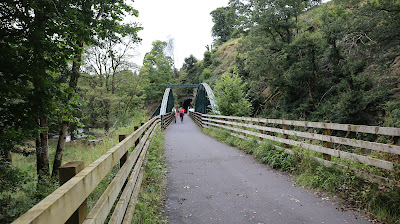
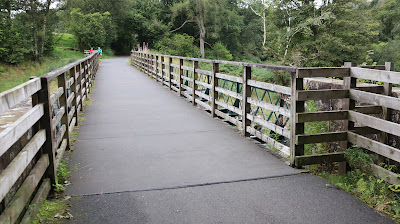
The route then passes through a pleasant woodland environment. Traffic noise from the A66 is replaced by birdsong and the sound of the river, which runs to the right. After the line closed, much of the old trackbed was used as a footpath, with the ballast forming the path's surface. However, when the current path opened at the end of 2020 the route had been re-surfaced throughout using tarmac. Some people complained about this, as they said it should have been left as it was, however, the tarmac surface is easier to maintain, more resistant to flooding, and opened the path up to wheelchair users and leisure cyclists. Walking it is not unpleasant.

Track-side furniture remains along the route, although not being a total railway nut I am never quite sure what it is I am looking at. I would suggest this is a device to hold signal wires, or maybe a tensioner for a telegraph pole. Actually, I have no idea. I'm sure that someone out there in internet land can lend a hand with the identification.


After half a mile or so, the path enters a short cutting. The steep banking on the left is supported by stonework. On the right, there is no need for such support.


A platelayers hut, converted to a shelter. This is actually on the right hand side of the path, but I walked past it to take the shot as a group of young ladies had stopped for a spot of lunch and a gossip, and I didn't think that they would be terribly happy for me to take a picture of them. Generally, the path was quite busy, but I have walked it when it has been deserted. Much depends on the time of year and the weather. There were a lot of children, local I presume, enjoying the last day of the summer holidays.


More track-side furniture, this time a sign saying ½. But half what? Well, actually, I do know this one. About a quarter of a mile further on is another, saying ¼, a quarter of a mile from that one is an old crossing, probably once a road leading to a farm. 


The second crossing of the River Greta, followed immediately by a small tunnel. The rock in these parts is fairly hard, and the railway engineers found it easier to tunnel through it than create a cutting. 


The aforementioned tunnel, possibly one of the shortest rail tunnels ever built. I wonder if anyone actually knows where the shortest tunnel ever built is. (I don't, by the way!).


Rawsome's Bridge, which at first sight appears to be a different design from the others, however, it is still a Bowstring Bridge, it is just that it is inverted, so the curved 'bow' structure is beneath the trackbed. Why it was made like this is not clear, but it would certainly have improved the views of the river from the train.


View of the river from the bridge. It looks peaceful enough, however, as we'll see, it can be very destructive.


The flanks of Blencathra to the right of the path. Most of the water that falls on that mountain ends up in the river. About a quarter of all the rain that falls on the Helvellyn Range, plus half the rain that falls on the mountains of the central Lake District also ends up in the river, as the catchment includes Thirlmere reservoir. That's a lot of water for one river. 

The river has a plentiful supply of brown trout, and this heron knows exactly how to catch them! He was too quick for one unfortunate fish, and also too fast for my camera. Shortly after this shot was taken he'd snatched his prey and was off.


This is Brundholme Bridge, and you'll notice it is not the same design as the others. This is because the original was unseated from it's stone abutments by Storm Desmond. The river was also widened by the storm, so although the bridge was salvaged, it could not be used. A new replacement was made.


Is that an ice cream van on an adjacent road? Should I? After all, it's a warm day. And I read somewhere that ice creams on walking routes have no calories!

A second platelayers hut, again converted to a shelter where weary walkers can polish off their ice creams without being attacked by seagulls!

 
A dead tree stands defiantly on the river bank. 


A little further on from the tree, erosion on the far bank of the river. This was caused by the flooding in 2015, when Storm Desmond wreaked havoc throughout the Lake District. Over 350mm of rain fell in 24 hours on the 5th and 6th December 2015. Now, the yearly average for London is about 560 mm a year, so to get 350 mm in a day is, well, pretty wet! That water had to go somewhere, and a lot of it ended up in the River Greta. 


At this point the path runs away from the track bed, which is clearly visible on the right hand side of the river. The track ran on an low embankment, which has been retained in order to prevent the river from washing away the footpath should more flooding occur. ( I say 'should', it undoubtedly will).


After just under a quarter of a mile, the path rejoins the track bed.


White Moss Bridge; again, a new structure since the old bridge was washed away by Storm Desmond.


An information post near to the bridge, showing the damage caused by the storm.


Yet more track-side furniture. But what is it? I suspect it was used to store ballast or something similar, or maybe sand that could be sprinkled on the track during wet periods. I'm sure someone knows the answer, but unfortunately I don't.


Brundholme Road bridge, an inverted Bowstring bridge that survived all storms as the railway is considerably higher than the river at this point.


Yet more erosion caused by the storm, however, nature has a way of bouncing back, and the vegetation is slowly crawling down the slope. I have a photo, taken at this point in 2020, which shows how bad the erosion was. 


The previous picture was taken on the left side of the path. This is the scene looking the other way. The river is flowing away from the camera. The holiday park is 'Low Briery' holiday park. 


OK track-side furniture experts. What on earth is this? It is made of wood. There are no paths close by, so it is not a footpath sign. It stands on the left hand side of the path.


There are eight river bridges, but road bridges such as this one are a rarity on this line. This is the first one, and heralds the approach to Keswick.


There are some lovely views of the river on this stretch of the walk. This is my favourite, the river to the right of the path, with Latrigg the fell in the background.


We've reached another tunnel, and although the portal is new, the actual tunnel is as old as the railway. It is called Bobbin Mill tunnel, although in the true Cumbrian tradition of understatement, most locals called it the Big Tunnel. Just before the tunnel used to be an old bobbin mill, presumably not called the Big Bobbin Mill! Above the portal is a fence protecting the main A66 road, although what it is protecting it from I have no idea.


Looking back at the tunnel, with the modern road, complete with the Lake District's only flyover. The A66 is dual carriageway at this point. When the railway closed, the tunnel was in-filled and sealed to prevent it from collapse, and also to protect the flyover from damage should a collapse occur. Re-opening it required strengthening work on the embankment, and the removal of 4,000 tonnes of material. The tunnel was also lengthened. Despite it being very rainy in Keswick, no naughty railway engines called Henry were bricked up in the tunnel.


Not only is the trail a footpath, but it is also part of the C2C cycleway, so if you don't want to walk, you can ride it.


The last overbridge. This one carries the main road east out of Keswick.


More track furniture. But again, what is it? Answers on a post card please.


The path runs on an embankment as it enters Keswick. The substantial fence on the right, which has a hedge on the other side, provides privacy for the residents of the nearby houses.


You get two bridges for the price of one here. The main road out of town runs beside the river. The railway crosses both. Back in 1970 I was lucky enough to see a train cross this bridge as we travelled along the road, heading for Grasmere. 21 months later, the railway closed.


The view of the river from the bridge, looking towards Fitz Park and the town centre.


Journey's end, with just one more bridge to cross - a minor road.


The end of the path. The ramp on the left runs up on to the old station platform, while the main path stays on the track bed.


What remains of Keswick Station, now partly preserved and part of the Keswick Hotel, where I worked for a week in 1973 (don't ask!).


The most boring picture of the walk, in fact, possibly on the whole of the internet. Keswick station had two platforms, but this is all that remains of one of them. It is now an overflow car park for the leisure centre.


The station sign, something many a tourist would have been really happy to see over the years. For the last quarter of a century there has been a campaign to bring the railway back. It has the backing of a number of organisations, including the National Park Authority and local councils. However, any reinstatement is likely to be many years into the future. The National Park Authority have put forward a plan to extend the railway footpath to the old station at Thelkeld, which is a good mile from the village. If approved, the extension could be open within the next couple of years. 


And finally.... not actually on the walk, but certainly of interest to any railway enthusiasts. About half a mile away, in the graveyard of Crosthwaite Parish church, is a surprising grave. To reach this part of the cemetery, you actually cross the remains of the old trackbed. Rail enthusiasts of a certain age will surely remember Bishop Eric Treacy. He was an avid railway photographer who published a number of books of photographs showing the railways in the north of England from the 1930's through to the end of steam. He died in 1978 on Appleby Station whilst waiting for a rail tour hauled by 'Evening Star', which some said was a fitting tribute to his life. He left a collection of over 12,000 railway images, which are held at the National Railway Museum, in York.

Friday, 4 October 2024

Walking – natures natural medicine

I think it is fair to say that the 2020 Coronavirus pandemic was not a good thing. However, for those that survived relatively unscathed, which in the UK is actually a large proportion of the population, there was one consequence of the pandemic that has the potential to have a positive effect on society for years to come. Put simply, the lockdown restrictions led many people to start walking more, usually because they had few options and wanted a good reason to get out of the house.

Those that did not tend to walk very much before the pandemic quickly discovered that walking was actually a good thing to do. It added physical activity into their daily routine without costing extra money. What many also discovered was that, at a time when the country was being ravaged by the effects of an illness, taking a daily walk had clear benefits on physical health for people of all ages. Not only was it good physically, but at a time when the stresses and strains of being cooped up inside were taking it's toll on families around the country, that daily walk also had a positive effect on mental health.

For those of us that walk regularly as part of our daily routine, these revelations came as no surprise. However, now that the pandemic is fast becoming a distant memory, do those that discovered the benefits of walking during the dark days of 2020 intend to keep up the habit, or will they slip back into their old ways?

It is my belief that they would be wise to continue keeping the daily or weekly walk as part of their routine, in fact, I am convinced that it would be most beneficial if they could actually increase the amount of walking that they do. To illustrate my point, I've put together this countdown of my own top ten reasons to walk more, and to keep on doing it as I approach old age (actually, I'm not approaching old age, I've reached it!!!!). Note that this countdown is based upon my own experiences. I've been leisure walking for many years, and have also had the good fortune to do it as part of my employment. But I reckon I am not alone in reaping the simple benefits of simply putting one foot in front of the other in aid of good health.

So, without further waffling, here are my top ten reasons to enjoy a regular country walk. 

At 10 - It gets my creative juices flowing.

I'm not the world's most creative creature, but even so, when I walk I think, and that leads to me being at my most imaginative. I actually came up with the idea for this article whilst strolling beside Windermere lake. Regardless of where I am walking, my creative juices start to flow within minutes of setting off, and most of my best ideas come whilst I am outside enjoying a good walk.

At 9 - It burns the fat

I'm talking calories here. I love eating, so taking them in is no problem, but using them up is a different matter. I could visit the gym, or go for a swim, both really good activities, but the nearest gym will cost me a fortnights wages just to join, and I'm actually one of the very few people who doesn't like swimming. (I know that is strange, but I'm not really a lover of chocolate cake either!) Walking, however, I really enjoy.

How many calories I use on each walk depends on how far and fast I walk, but I once calculated that a one hour walk would burn just under 300 calories. (this is not the same for everyone it depends on your size and the speed you walk and also the terrain you are walking on). Walk two hours and I've earned myself a nice piece of battered fish. Another hour and that's the chips sorted. The mushy peas, are, evidently, practically calorie free! 

At 8 - It protects the ticker

I'm quoting my doctor here, who, on the rare occasions that she sees me always commends me for walking to the surgery (although not in the rain!). Seriously though, walking makes the heart beat faster, increasing your cardiovascular performance. It also helps to keep your blood pressure down, in fact, a friend of mine who had high blood pressure and did not want to take pills for it was told by the cardiologist that the alternative was to walk five miles every day - so that is what he did. 20 years later he's still going strong at the age of 91 (although he's down to just 2 miles a day now).

According to an article I read online, regular walking at what was termed 'moderate intensity' is a factor in lowering cholesterol as you get older, which is not only good for your heart, but also helps you to keep walking.

At 7 - It gets me outside

This might seem obvious, but going for a walk actually involves getting out of the house, which is actually good for your health. The thing is that I am a bit of a nature lover. I find it calming to be outside in a natural environment. Which begs the question, is it the walking that is good for me, or just the nature? What if I drove to a nice spot, parked up, got out my comfy folding chair and just sat in the sunlight enjoying the world around me? Doing so would, after all, be very relaxing. Except.... it is the getting there that is the problem. The driving bit. I don't mind driving, and over the years I've done a lot of it, but it is stressful, and I do confess that it takes the edge off the pleasure of getting outside.

If I am going somewhere that is too far away to walk, I like to take the bus if possible. It is, for me at any rate, much less stressful. But if I am staying local, then I prefer to walk, and unless it is a trip to the local shops, I prefer to head to a green space.

At 6 - It puts the newness back into my knees

Now, I have to confess that I have never really suffered from joint pain. In that, I count myself lucky. Arthritis, knee problems and back pain are all commonplace, and can often affect people who are active, as well as those who are not. Something that did happen to me a few years ago was knee pain, which I started to get when descending hills. I remember one day in particular, coming off Nab Scar, overlooking Rydal Water in the Lake District. Every step down was more painful than the previous one, and upon getting home the first thing I did was arrange an appointment with my doctor.

After examining my knee, and asking about when the pain occurred, she gave me not medicine, but advice. 'Throw away your walking cane!' she said.

I always used my cane when descending a hill. She told me to try walking downhill without it. Her theory was that, as walking lubricates the joints and also strengthens the muscles that support them, using my walking cane for support when I didn't need to was actually reducing the benefit that walking gave me, hence the pain. She told me to give it a try for three months and if there was no difference to go back and see her. I've not been back, nor have I been bothered with knee pain since. I didn't throw away my canes, however. They go with me on every walk and are very handy. I just don't habitually use them for walking downhill.

At 5 - It stops me from getting ill

I'm talking about my immune system here, an amazing part of our bodies that we barely ever think about, even when we do get ill. Our immune system fights infection. How it does so is a wonderfully complicated process that I am not going to even attempt to cover. All I know is that in order to ensure that the immune system works correctly we need to do just two things - eat a good, balanced diet, and get plenty of exercise.

There is lots of research on this. What it seems to highlight is that people who exercise regularly are known to get fewer viral infections, and less severe symptoms when they do get sick. I can add my own observation to that. At periods in my life when I have not walked regularly, mainly due to work and family commitments, I've tended to get sick more regularly, and also be sick for longer. I know I am not the only one who this applies to. Friends of mine who also walk regularly are seldom ill, and when they are tend to be back on their feet in less time than the more sedentary folks I know.

Not only does walking positively effect my immune system, but it also seems to boost my energy levels. This has much to do with the fact that exercises such as walking increase the levels of oxygen absorption and hormone levels in the body, making you feel more energetic.

At 4 - It does wonders for my mood

Folk who know me are aware that I am not generally a grumpy person. I don't suffer from extreme bouts of stress, I'm not prone to what might best be described as negative emotions. One of my favourite songs is 'Always look on the bright side of life' from Monty Python's 'The Life of Brian'.

Of course, my positive outlook on life could be due to my personality - kind, caring, thoughtful and incredibly humble - not at all self congratulatory in any way. But actually, I think in reality it is due to a range of factors, one of which is enjoying regular walks. Going for a walk de-stresses me, not that I am overly stressed to start with, but in times past, I have been. When the going got tough, getting out for a walk certainly helped me no end. It cleared my mind of all the daily clutter, and helped me to think clearly about the really important issues that my family faced. It also reduced what I think is best termed as 'workday fatigue'; that drained feeling that many of us experience at the end of a hard day. In fact, for many years I was actually quite baffled at how, when I felt tired and drained of energy, getting out of the house and going for a short, brisk walk actually reduced the fatigue and helped me to sleep better.

At 3 - It improves the quality of later life

Most of us want to live for as long as possible. I know I do. But it is not just about living longer, it is about the quality of that life in old age. The very last thing I want to do in later life is to spend each day sitting in a chair watching daytime TV. It might suit some people, after all, we are all different, but it certainly is not my cup of tea. My experience with other people, some of whom are 20 years older than me, is that the secret of an active old age is to be active at all ages. Do the things you enjoy, as often as you can. Dancers dance, runners run, swimmers swim, and walkers walk. The key is not to stop. And since I can't dance for toffee, don't run, not even for a bus, and dislike swimming, it is walking for me. It is easy to do, enables me to maintain a social life, and best of all, it's free!!!!!

At 2 - It's so easy!

OK, I'll admit it. For someone who is advocating physical exercise I'm a bit of a fraud because I am a tad lazy. I am a dishwasher kind of guy, since I hate washing up by hand. I once washed my car in the rain so I would not have to rinse the suds off! (BTW, this does not work very effectively unless the rain is pretty torrential). But I find that when it comes to short distances, walking is easier than just about any other mode of transport.

Take walking versus the car for popping to the shops. My shops are just under a mile away, and the walk to them is really easy. No steep hills to climb, no busy roads to cross. Driving takes pretty much the same route, so reaching the village is fine. Then the fun starts. I have to find a parking space, which in many cases is not actually close to the shop I want, resulting in me having to walk part of the distance anyway. Then there is the cost. Starting a car and driving it a mile does the engine no good whatsoever. It uses fuel, which has to be replaced, and parking it can be fraught with difficulty if no spaces are available. At peak times it is worse. Not only do I have to drive around to find a space, but the local traffic results in me crawling through the village being stuck in a queue.

Another issue is if I see someone I know on the journey. If I am walking, I stop for a chat. If I am driving I usually end up sailing past, pipping my horn as I do so in order that my friend does not think I am ignoring them. Others do not know that the horn is not intended for them. Sometimes the chap in front (it is always a bloke!) gets upset as he thinks I am criticising his driving, which leads to a potential road rage incident. I see road rage incidents fairly regularly. They are part of life. But pavement rage is rare, and public footpath rage seems to not exist at all.

Another advantage is that, if I am walking, I can go off-road, and take that nice little path that leads between the houses, across the park, beside the stream and on into the village. I can't do that in a car.

And now, finally, it's number 1, the top reason why I love walking......

Because I can

OK, stick with this for a bit, you'll see exactly where I am coming from.

About 30 years ago I took my wife to physiotherapy one day. Whilst sitting in the waiting room I got talking to a young woman who had brought her husband for his physiotherapy session. The story she told me was quite harrowing, although there was a ray of hope at the end of what seemed like a long, dark tunnel.

Her husband, (she never revealed his name, so I'll refer to him as John) had been severely injured in a car accident, the result of which was that he had serious spinal injuries, and had lost a leg. He had been fitted with a prosthetic leg, and was learning to walk again. The sad part was that they had been told that John only had a 30% chance of success. He was trying very hard, overcoming the fear and pain that accompanied his every step, but even so, he had no guarantee of success. Prior to his accident he was a runner. He'd completed several marathons, climbed all the major mountains in the British Isles, and, at the time of the accident, had just returned from Africa, where he had climbed Kilimanjaro. And there he was, at the age of 29, struggling to regain the ability to do something that most of us take for granted.

The meeting did not actually change my life a great deal. I walked as much as I could in those days, both at work and play. I had long since understood and enjoyed the benefits of walking. But what it did bring home to me was how lucky I, and the other members of my family were. We had our health, our limbs were intact and in full working order, and we used them for the purpose for which they were intended. But not everyone is so fortunate, and of those that are, not everyone takes full advantage of their fortune.

Humans evolved to walk. Our bodies are designed to do it. What we are not designed to do is sit down for large periods each day. We may have invented alternatives to enable us to go further and faster, but the fact remains that for the vast majority of the period when humans have existed, the only method of transport has been our own two feet.

I am lucky enough to live in the English Lake District National Park, surrounded by a wealth of stunning scenery. But even if you live in a city, there are wild spaces not too far away where you can get out and stretch your legs. Public parks, Country Parks, Riverside and Canal paths, all are available.

One of the most pleasing results of the 2020 pandemic was a report that said that many people had gone out and discovered walking routes close to their own home. Routes that, until 2020, they never knew existed. The pandemic may be over, but the health benefits of getting out for a walk every day, even if it is only for an hour, are long lasting, and for the vast majority of people, very very good for you.

How to Get Started

If you've never really done a great deal of leisure or health walking before, it's essential to start gradually. A mile is better than no miles. It doesn't take long to build up a level of fitness that lets you go further, but it is also the case that trying to go too far too soon can lead to problems such as injuries or pain. If possible try to do a short walk every day, or at least 3 times a week.

Pace yourself. The optimum speed you should try to achieve is 2 to 3 mph but again if you are just starting out, don't worry. The key is to be comfortable with how far you are going, and what speed you are walking at. It is not a race. Instead, take the time to notice the world around you.

That smartphone thingy that you see young people walking along looking at is not an essential piece of kit. (I am convinced that many young people are, in fact, remote controlled!). Taking it with you is a good idea, but you don't need to keep looking at it every 100 paces or so. What is essential are comfortable shoes (trainers can be good), warm clothing and, if you can find one, a friend to accompany you.

Stay hydrated. A small bottle of water for walks of over a mile is not a bad idea. The golden rule is 250 ml of liquid per mile. Oh, and before you leave the house, don't forget to pop to the loo first!

And now, to get you into the mood for a bit of country walking Lake District style, here's a video of a walk I enjoy doing on a regular basis. You never know, one day we might meet each other halfway up the hill!


Have fun, and stay safe


Tuesday, 27 August 2024

The Tale of Dunmail - Or, how a King lost his crown.

And now, a little historical intrigue amongst the Lake District fells. One of my favourite walks visits Grisedale Tarn, a moderately large spread of water that sits in the depression between Seat Sandal and Dollywaggon Pike. The tarn is on a six and a half mile long bridleway linking Grasmere with Patterdale. It's modest height, at just under 1,800ft, is in direct comparison to the high fells that surround it. The tarn adds to the bridleway's attraction as an early transport route, providing a ready supply of both fresh water, and fish.

On the Grasmere side, the tarn is usually reached by following the old bridleway beside Tongue Gill. But those who like a bit of historical intrigue might like to take an alternative route by following a path that skirts the northern flanks of Seat Sandal, via Raise Beck. The common start point for this route is the top of Dunmail Raise, which is on the A591 road between Grasmere and Thirlmere.

At the top of the Raise the road is a dual carriageway, and in the middle of the central reservation is a cairn, a large pile of stones. In fact, the term Dunmail Raise actually refers to the cairn and not the road. A "Raise" is an old name for a cairn, a construction which has been "raised up" by depositing stones.

The pass of Dunmail Raise, ie: the road that goes over the hill upon which the cairn stands, connects the Vale of Grasmere to the Thirlmere valley. It is the lowest route between the northern and southern parts of the Lake District, and as such has great significance in the history of the region.

Beneath the stones are reputed to be the remains of Dunmail, the last King of Cumbria, who was reputedly killed in battle on the very spot upon which the cairn is situated, in 945 ad.  To add to the intrigue, Dunmail's golden crown was salvaged by his warriors, who escaped into the mountains up the path beside Raise Beck, and threw it into the dark grey waters of Grisedale Tarn.

So, fact or fiction? Or a mix of the two? Was there a battle? Did the last King of Cumbria meet his end? Does he lie under that pile of stones? What of his crown? Is it still at the bottom of Grisedale Tarn, waiting to be rightfully claimed?

There is no definitive history written at the time of the alleged battle, however, subsequent writings  suggest that there is more than a smidgeon of truth in the story. There may well have been a battle in the region at some point in 945. It is known that Edmund I of England spent much of that year at war in an attempt to unify England and Scotland. Cumbria, then part of the kingdom of Strathclyde, was one of his main targets. 

However, if there was a decisive battle on what we now know as Dunmail Raise, then King Dunmail, or to give him his proper title, Dyfnwal ab Owain, probably didn't die in it. In fact, it is possible that he lived another 30 years, outliving both his aggressors, Edmund I of England, who was killed in 946, and King Malcolm I of Scotland, who died in battle in 954. To further muddy the waters, King Malcolm was known by the name of Máel Coluim mac Domnaill, and the top of Dunmail Raise appears to the southern boundary of the land gifted to him by Edmund I after the battle. All of which begs the question, who created the legend regarding the pile of stones, and what really happened to the golden crown?

Fast forward a little over 800 years, to the dawn of the age of tourism. The early guide book writers had very few reliable historical sources available to them. However, this minor detail did not put them off. They were very well aware that, when it came to history, a good amount of local folk lore could both fill in the gaps, and lift a boring historical story. The tale of the King who lost his crown, and whose remains lie buried beneath the large pile of stones on Dunmail Raise, had existed via word of mouth for 800 years. In the latter part of the 18thC, it was finally committed to print. The rich Georgian and early Victorian guide book readers were certainly enthralled by the legend, and since the early guide book writers were highly trusted for the quality of the information their books contained, they tended to believe every word.

In reality, the low pass between Grasmere and Thirlmere is more likely to have been territory where peace was negotiated, rather than a battlefield. Edmund I was determined to depose King Dunmail, as he suspected him of being in collusion with the Viking rulers of Northumberland, who had reneged on an agreement with Edmund not to invade his territories in the Midlands. There is evidence of a battle taking place close to Orrest Head, near Windermere. The word 'Orrest' is Old Norse for battle. The Cumbrians then retreated to what is now Dunmail Raise, pursued by the combined forces of Edmund and Malcolm I of Scotland.  With his force heavily outnumbered, Dunmail then took the decision to surrender. Edmund I accepted his capitulation, ceding the territory to King Malcolm I of Scotland. By doing so, Edmund achieved his aim of creating both safe borders, and harbouring peaceful relationships with his neighbours in Scotland. 

The terms of the surrender are not known, however, it is clear that by 950 King Dunmail had been granted power once again, this time in alliance with Edmund I's successor, Eadred. It was a move that had the approval of Malcolm I, and clearly part of what was a very dynamic political landscape, the aim of which was to rid both England and Scotland of Scandinavian influence. 

Modern folk lore confirms that there are definitely are no human remains beneath the pile of stones on Dunmail Raise. When the road was widened and the dual carriageway put in place, the cairn was actually moved from it's position close to what is now the northbound carriageway, onto the central reservation. The trouble is, knowing that spoils the story, so it is not something that you will tend to read in any 21stC tourist guide. 

But what of Dunmail's golden crown? If he was deposed, was he forced to hand it over as part of the peace agreement, or did some of his warriors dispose of it in the tarn before Edmund could get his hands on it? Once again, the folk lore is so much more entertaining than the truth, which is probably that Dunmail didn't actually have a crown, and certainly not one made of solid gold. The story is symbolic. Dunmail may have lost his position as King, but his true influence and power lay not in the hands of Edmund or Malcolm, but amongst the mountains and tarns of the region. Indeed, Dunmail's knowledge and influence amongst the people who lived and farmed in the mountains of Cumbria may have been the reason why he was allowed back into power so quickly.

Don't let the train take the strain!

At the southern tip of Windermere (the lake), is Lakeside, a small hamlet of scattered houses, a large hotel and the terminus of both Windermere Lake Cruises, and the Lakeside and Haverthwaite Railway. The railway runs for three miles, from Lakeside to Haverthwaite, a small village situated close to the main A590 road that links the M6 motorway with the industrial towns of Ulverston and Barrrow in Furness. 

The route of the A590 is a modern one. In days past it not only ran through the village of Haverthwaite, but also crossed the river Leven by a narrow bridge close to what is now the Whitewater Hotel, in the village of Backbarrow. To the 21stC motorist, being able to avoid the queue inducing bridge is a bonus, especially as, at first glance, the village of Backbarrow has little to offer the visitor. But, as we shall see later, Backbarrow is not all it seems, especially if you have an interest in history and industrial archeology.

For most visitors, the cruise down the lake from Bowness or Ambleside, followed by a ride on the short, but very pleasant railway to Haverthwaite, is an enjoyable day out. However, aside from a visit to the small engine shed, a quick snack in the cafe, a browse around the tiny gift shop and, if you have children, a visit to the small kiddies playground, there is little to do at Haverthwaite. Consequently, those passengers that start their journey at Lakeside have a tendency to get the next train out of town, and head back the way they came.

One alternative to catching the train both ways is to walk one way, preferably the outer route from Lakeside to Haverthwaite, then return to Lakeside by train. The walk is just four miles by the route outlined below, and on a fine day is utterly delightful. Although not totally flat, there are no big hills to climb. The route follows a specially made off road footpath for the first mile and a half, before taking to a minor road for the remainder of the walk. You'll never be too far from the railway, and will pass through a parkland style setting on the early part of the walk. Once beyond the hamlet of Newby Bridge, the minor road runs through pleasant woodland before dropping down to the village of Backbarrow, a small riverside village that is not as it first appears.

Lakeside Steamer Pier, Lakeside, Cumbria

The walk starts at the ferry pier. Walk away from the lake and turn left to walk past the Aquarium and on to the far end of the car park,

A sign highlighting the West Windermere Way, at Lakeside Cumbria
At the end of the car park there is a gate leading to a footpath that runs to the right of the railway line.

Start of the public footpath from Lakeside to Newby Bridge, Cumbria

Simply follow the path for the next mile, enjoying the views as you go.

Steam train on the Lakeside and Haverthwaite Railway, seen from the footpath between Lakeside and Newby Bridge.

You'll know when you are approaching Newby Bridge, as a footbridge crosses the railway. 

Lakeside and Haverthwaite Railway steam train approaching Newby Bridge

Having arrived at Newby Bridge, the path follows the road that runs along the front of the Swan Hotel.

The Swan Hotel at Newby Bridge, Cumbria

At the junction, cross the road to take the minor road that continues alongside the river, with the railway to your right. 

Newby Bridge and the River Leven, Cumbria
 

Pass by Newby Bridge Station, and continue along the minor road to cross the rail bridge.

Steam train leaving Newby Bridge Station on the Lakeside and Haverthwaite Railway, Cumbria

At first there are views to the left, out across the Leven Valley, with the railway following the course of the river. Beyond that, running behind the trees in mid picture, is the main A590 dual carriageway. The Leven Valley is only 6 miles from Windermere to the sea. Nowadays there is little industry in the valley, but in days past it was a hive of activity, as we will see later. 


The minor road runs gently uphill for just under a mile. Privately owned woodland obscurs any views of the valley, however, on a nice sunny afternoon it is not unpleasant as the road tends not to be very busy.


The highest point of the walk is this junction, where you need to turn left, following the cycleway sign to Haverthwaite.

Shortly after is another junction, where again, you need to turn left. It is downhill all the way now to the village of Backbarrow.


The woodland you are walking through used to be coppiced. The trees were cut down to allow new shoots to grow from their base. About once every seven years the new shoots would be cut away and used to make charcoal, a substance that was in high demand during the past century. It was used in the iron and steel making industries, as well as for making gunpowder.


On the right hand side of the road there are several areas where rock has been taken for use in building work. Over the years, these mini quarries have been reclaimed by nature, and make a pleasing feature as you continue down the hill.
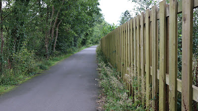
After almost three quarters of a mile of descent, you reach the bottom of the hill, and a rail bridge. Note that the track here used to be double, the bridge abuttments for the track that is no longer in place still exist, but the overbridge part has been removed.

If your timing is right, you may just catch a glimpse of a passing train!


It is a short distance from the railway bridge to the houses on the edge of the village of Backbarrow. The railway line can be seen running centre of picture.

After another quarter of a mile, the road runs alongside the river. Three things to note here, first the drainage pipes from the garden running through the wall, second the new houses on the other side, and third, in the distance on the right hand side of the river, a low brown building that is part of the Lakeland Motor Museum. The museum was built in an old cooperage. It made barrels for the mills and dolly blue works, of which more in a moment. Later it became the packaging department of the Dolly Blue works.


A little further down, the river narrows and runs under a stone bridge. The buildings on the other side were formerly the aforementioned Dolly Blue works. Originally known as the Lancashire Ultramarine works, the mill opened in the late Victorian period and for 90 years manufactured the little tablets of blue dye that most housewives in the early and middle part of the 20th century put into their clothes wash to make the white things appear white, and not yellow. It wasn't a bleach, but a colouring, and those of us of a certain age can well remember it being widely for sale in shops. 


The old Dolly Blue works is now the Whitewater hotel. Some public areas of the hotel still display items signifying the history of the site.  The mill closed in 1981.


The power of the water going under the bridge can be sensed in this shot. The River Leven drains Windermere, so when the Lake District has heavy rain, about a quarter of all the water that falls from the sky ends up going under this bridge. In 2005, 2009, and again in 2015, the village was flooded and in both 2009 and 2015 the bridge was severely damaged and the hotel flooded. Also, the A590 used to run over this bridge. The new section of road by-passing the village was built in the 1960's in order to ease traffic congestion. 


Don't cross the bridge, but turn right and follow the left hand pavement, which is actually a painted line on the road, for a short distance to reach the remains of Backbarrow Ironworks. The first sign of their existence are the 'paddles' at the sluice gates used by the works to control the flow of water. They are in remarkably good condition.

A little further on, a display board beside the road offers plenty of information about the site. 


It is not a big site, and work is currently being undertaken to tidy it up as it has stood idle and derelict since the works closed in 1966. According to the web site associated with the site, the iron made here was of very high quality, which enabled it to compete with much bigger sites. Singer sewing machines were made with high quality iron from Backbarrow, so if you have an old one you own a bit of Lake District history.


The telegraph pole from the railway can quite clearly be seen in the gap between the houses, some of which are social housing, and others privately owned. The village also has a junior school, and a doctors surgery, but no shop.

Close to the end of the walk, and Haverthwaite station. The minor road through the village meets the modern, and usually very busy A590 road here. There is no need to cross the road to reach the station.  To the left of the hedge is a little footpath, which avoids the need to walk along the grass verge!


100 yards further on, to the left, the busy road, on the right is the car park for Haverthwaite railway station.

Depending on your timing, you may have time to visit the delights of the station. It has a small cafe, an engine shed, a small book and gift shop, plus a kiddies playground set amongst the trees. Note that if you arrive at Haverthwaite after the last train has departed you can catch a number six bus back to Windermere from a stop close to Haverthwaite station. This is often a double decker, and a top deck seat on the journey along the A592 from Newby Bridge to Windermere is a very enjoyable experience, especially if  you sit on the left hand side of the bus. 

However, nothing beats the train ride back to Lakeside.